Topographic surveys for the M6 metro line – Bucharest

Project developed in collaboration with Metrorex Bucharest

Project type: Topographic elevation

Project Partners

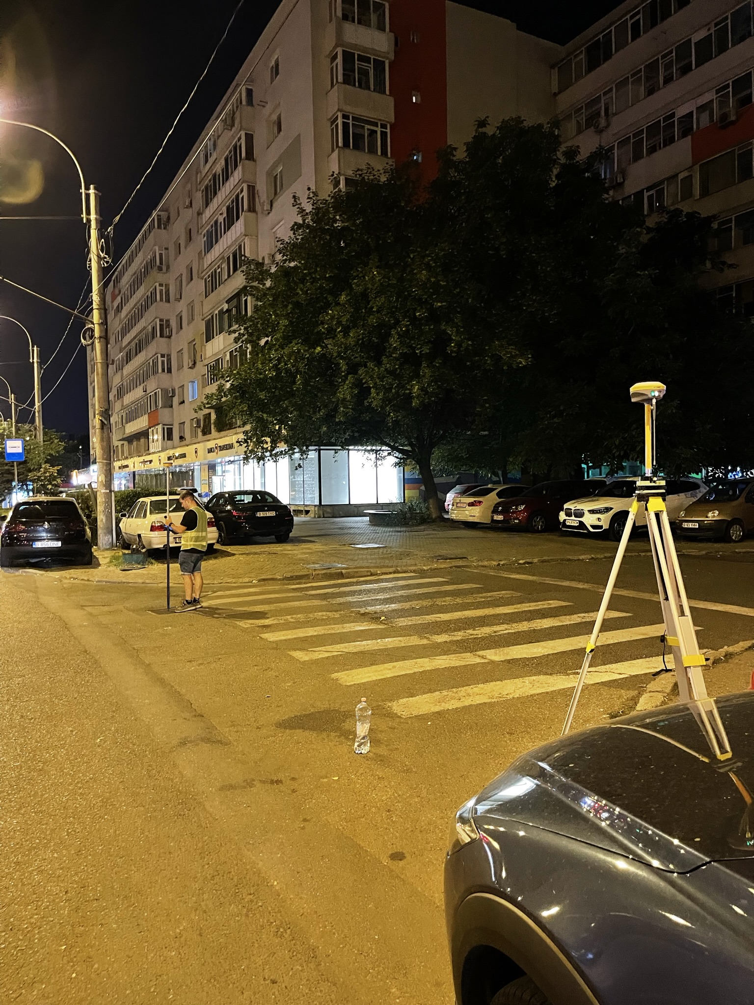
Within this project, our company realized topographic survey works for an area of about 35 hectares, located in Bucharest. The precise measurements, carried out with state-of-the-art equipment, ensured an essential precision for the establishment of reference points in the field, essential for the design phase of the new M6 metro line.

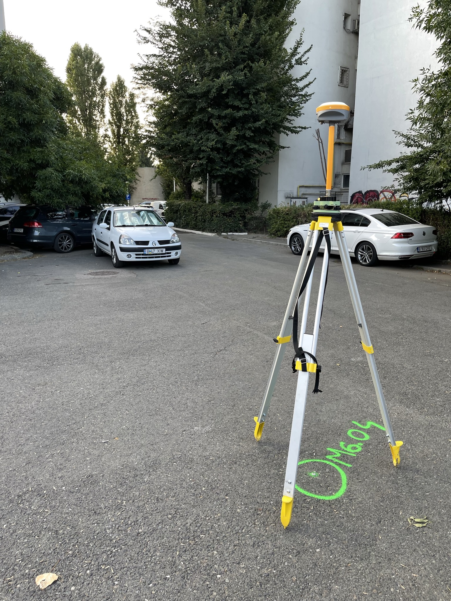
Rover base equipment was used for error compensation to collect detailed geospatial data. The strategic placement of the equipment and the optimization of observation points made it possible to obtain an accurate digital terrain model, even in congested or hard-to-reach urban areas

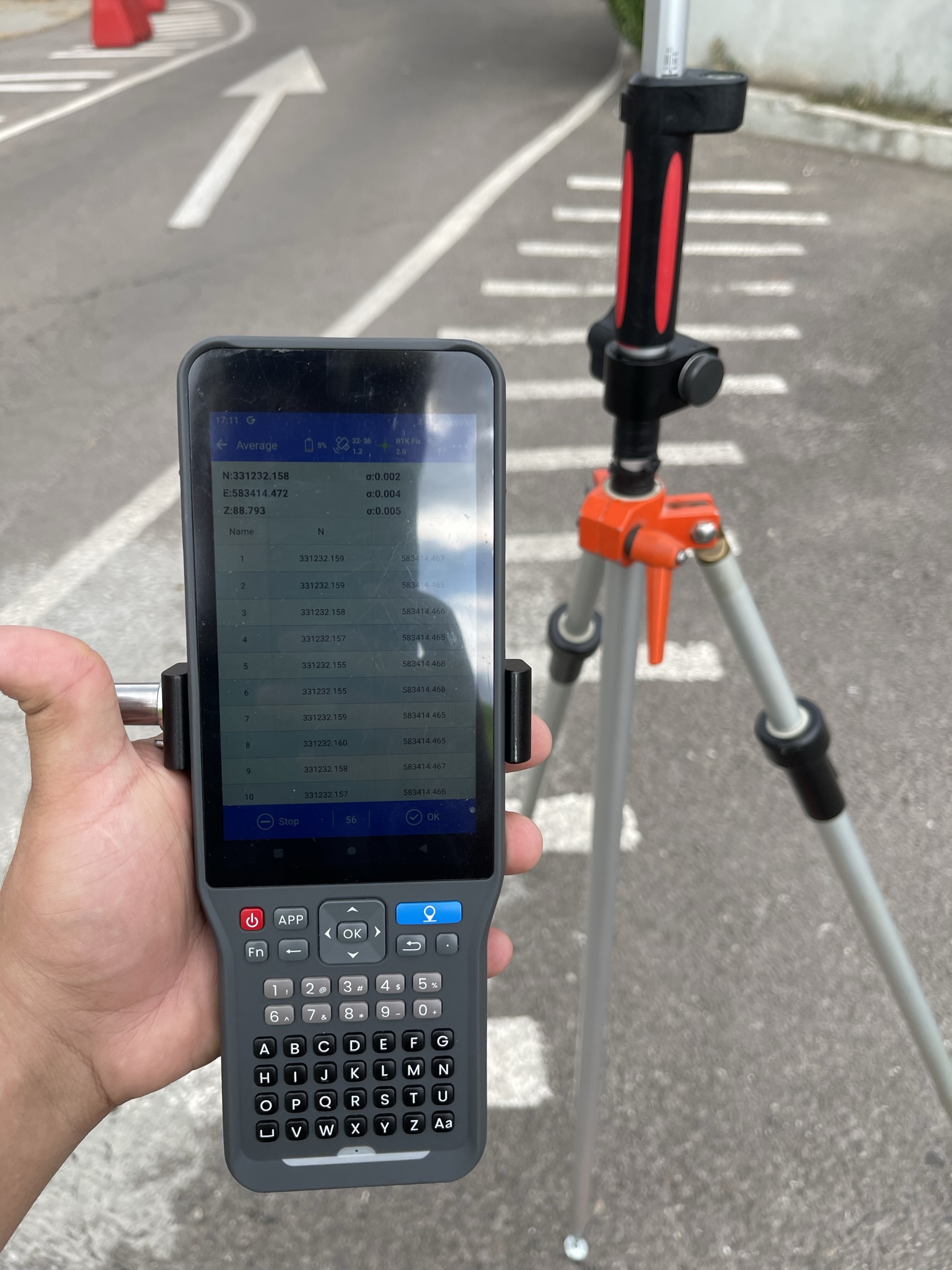
Real-time checks were performed to verify the correctness of the work through aadvanced checking system, significantly reducing the margin of error. The information was then integrated into the topographical plans and passed on to the design teams, providing a solid foundation for the construction of the new metro line.

Interdisciplinary collaboration for sustainable infrastructure

The success of a large-scale project such as the extension of the Bucharest metro network through the M6 line depends not only on the technical accuracy of the measurements, but also on the ability of the teams to work together in a coordinated and efficient way. On this project, our firm worked closely with architects, civil engineers, planners and public authorities to ensure the seamless integration of topographic data into the design and execution phases.

We actively participated in technical meetings and in the analysis of construction solutions, providing all parties involved with clear, up-to-date information adapted to the real needs of the site. Constant communication and data exchange in a standardized format helped to avoid errors, reduce working times and optimize the route of the future metro.

Through this collaborative approach, we contributed not only to delivering accurate topographic documentation, but also to creating a solid foundation for the development of a modern, safe and sustainable infrastructure that will bring real benefits to the inhabitants of the Capital.

Ready for a bug-free project?

Contact us now and let’s talk about how we can support your project with highly accurate surveying and cadastral services.