Project developed in collaboration with RETTER and Graphein
Project type: Topographical assistance for major road infrastructure
Project Partners


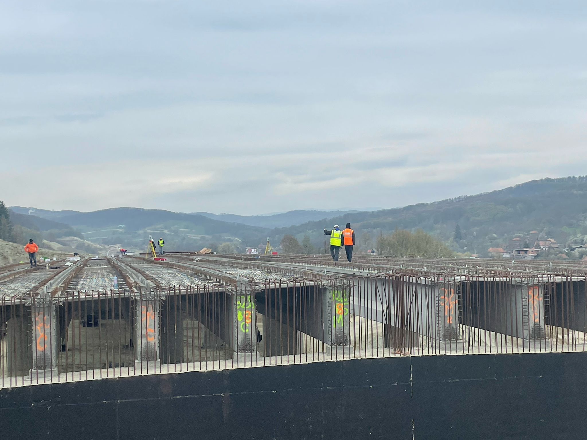
Our firm has been actively involved in providing extensive surveying support services for three of the most important road axes under construction in Romania: A0 Ring Highway of the Capital, A1 Highway – part of the Pan-European Corridor IV, and A7 Highway – also known as Moldova Highway.
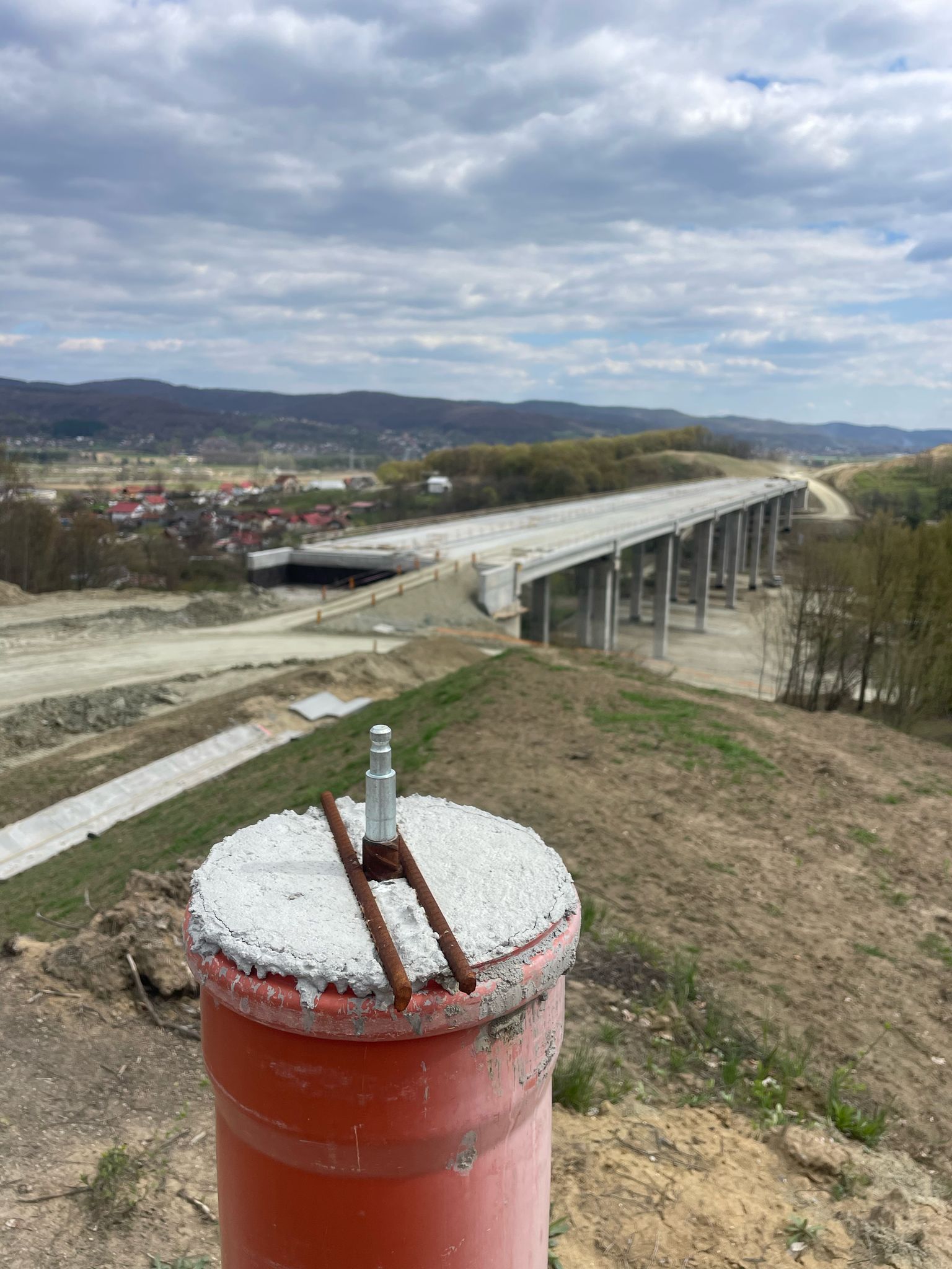
Our interventions covered the entire execution workflow, from earthworks, to complex structures such as bridges, overpasses and viaducts. Each segment required precise mapping, rigorous checks and a constant presence of our team on site to keep the quality of workmanship at optimal parameters.
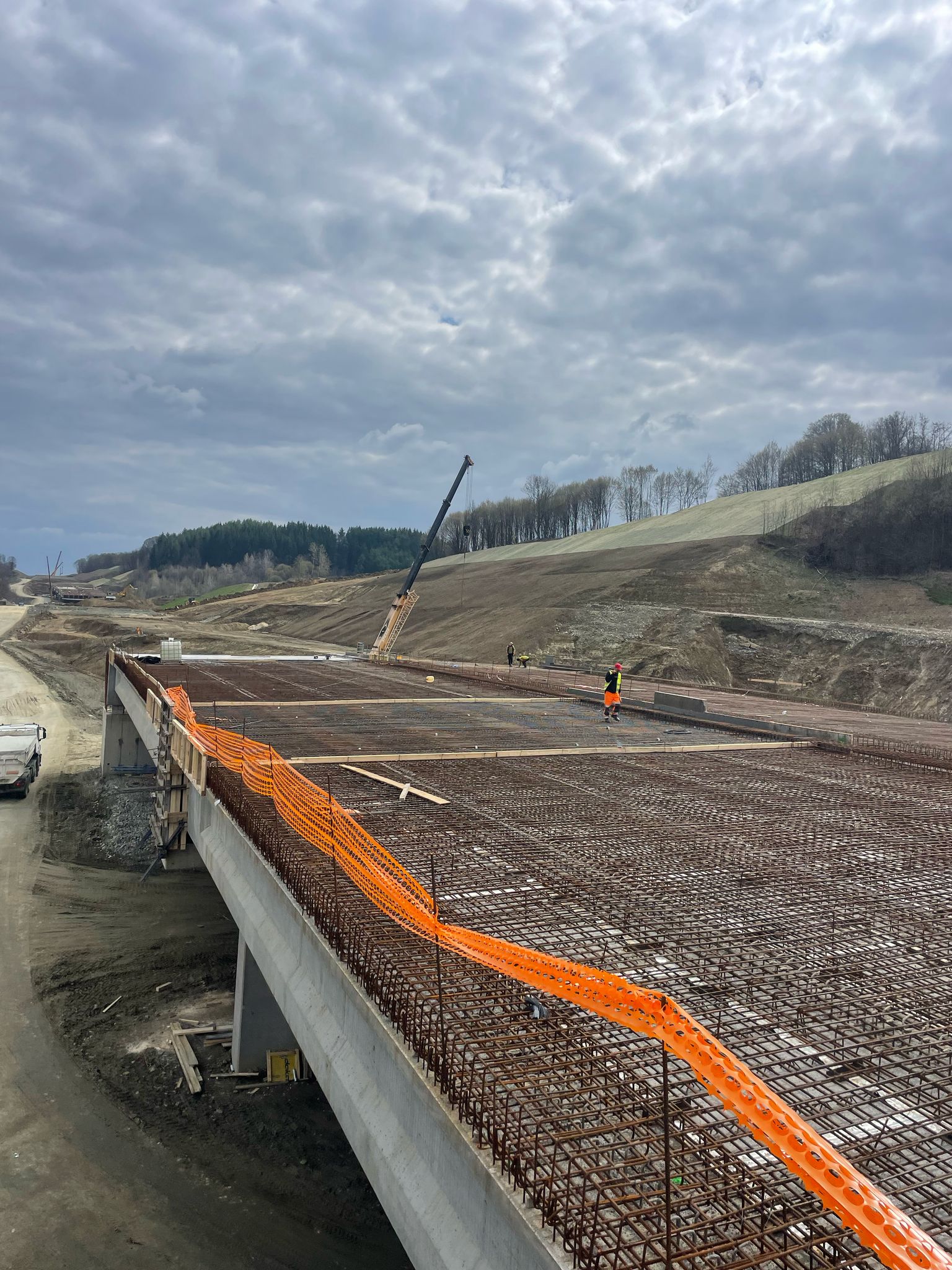
We used state-of-the-art equipment adapted to each stage: Base-Rover GPS systems with external radio for large-scale open-field work, and high-precision total stations for critical checks and positioning in areas with complex structures.